Accès à la carte ICI
Les deux couches sont également intégrées à l‘atlas géographique du cours ICI
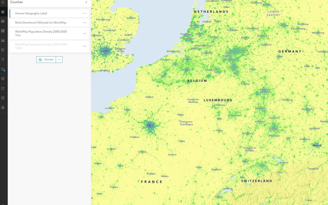
WorldPop Total Population 2000-2020 1km
Cette couche offre un précision pour des cellules de 1 km². L’interrogation de la couche donne la valeur de l’effectif sur un pixel d’1 km².

A l’échelle locale, la couche ci-dessous prend le relai.
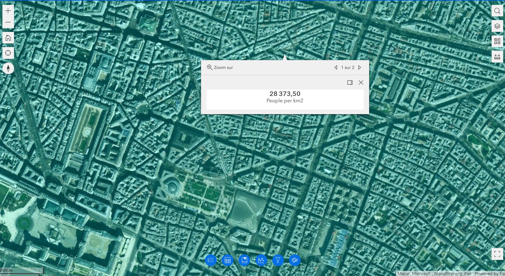
WorldPop Total Population 2000-2020 100m
Cette couche offre une précision qui permet de distinguer les densités à l’intérieur des aires urbaines ou des campagnes.
Elle n’est opérationnelle qu’à l’échelle locale et peut prendre 10 à 15 secondes avant de s’afficher. Placée sous une autre, p.ex. l’imagerie, elle permet d’interroger directement les espaces en termes de densité.
Source: WorldPop estimated the total population for each cell in this data using a random forest-based dasymetric redistribution model (Stevens, F. R., Gaughan, A. E., Linard, C., & Tatem, A. J. (2015). Disaggregating census data for population mapping using random forests with remotely-sensed and ancillary data. PloS one, 10(2), e0107042). The estimates in this layer use WorldPop’s Top-down unconstrained method which estimates the total population for each cell with a Random Forest-based dasymetric model. This diagram visually describes this model that uses known populated locations to analyze imagery to find similarly populated locations.
The DOI for the original WorldPop.org total population data is 10.5258/SOTON/WP00645.
Recommended Citation: WorldPop (www.worldpop.org – School of Geography and Environmental Science, University of Southampton; Department of Geography and Geosciences, University of Louisville; Departement de Geographie, Universite de Namur) and Center for International Earth Science Information Network (CIESIN), Columbia University (2018). Global High Resolution Population Denominators Project – Funded by The Bill and Melinda Gates Foundation. Accessed from https://worldpop.arcgis.com/arcgis/rest/services/WorldPop_Total_Population_1km/ImageServer, which was acquired from https://www.worldpop.org/doi/10.5258/SOTON/WP00645 on 15 Sep, 2021.
WorldPop Total Population 2000-2020 1km
This layer contains WorldPop’s 1-km resolution annual estimates of total population from the year 2000 to 2020. WorldPop estimated the total population for each cell in this data using a random forest-based dasymetric redistribution model. The estimates in this layer use WorldPop’s Top-down unconstrained method which estimates the total population for each cell with a Random Forest-based model. This diagram visually describes this model that uses known populated locations to analyze imagery to find similarly populated locations.
Ces couches sont intégrées à l‘atlas géographique du cours ICI